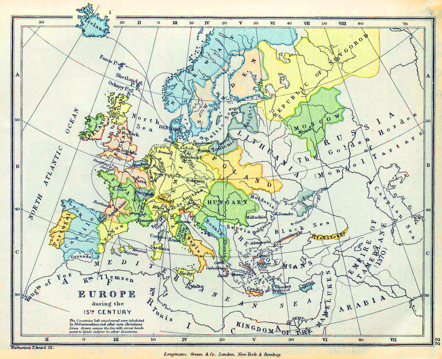
If you look at a map of Europe in the 16th century, your first instinct is probably to look for the borders. You want to see where France ends and where Germany begins. But here's the thing: those lines didn't really exist. Not like they do now. Back then, a "border" was often just a vague suggestion based on which local lord was currently paying taxes to which king. It was a mess. A beautiful, bloody, confusing mess.
The 16th century was the moment the world cracked open. You had the Renaissance hitting its stride, the Reformation tearing the church apart, and explorers like Magellan and Columbus proving the world was way bigger than anyone in Paris or Rome had imagined. This transformed the way people drew maps. They went from being religious art pieces to actual tools of power.
Mapping was the high-tech industry of the 1500s. It was the Silicon Valley of the Renaissance.
The Holy Roman Empire Was a Geo-Political Nightmare
Seriously, look at the center of any map of Europe in the 16th century. You’ll see this massive, splattered inkblot labeled the Holy Roman Empire (HRE). It wasn't a country. It was more like a dysfunctional homeowners association with three hundred members who all hated each other.
You had tiny duchies. You had free imperial cities. You had prince-bishoprics where the guy in charge was both the general and the priest. Voltaire famously quipped much later that it was neither holy, nor Roman, nor an empire. He wasn't wrong. If you lived in Nuremberg, you were technically under Emperor Charles V, but your day-to-day reality was governed by local councils and guild laws that had nothing to do with what was happening in Vienna or Madrid.
Charles V is the key figure here. He was the ultimate 16th-century nepo baby, inheriting so much land through the Habsburg line that he basically owned half of Europe and a massive chunk of the Americas. His "empire" on the map looked like a jigsaw puzzle dropped on the floor. He ruled Spain, parts of Italy, the Netherlands, and the German lands.
Imagine trying to manage a kingdom where you have to travel three weeks by horse just to get from one part of your territory to another. Communication was slow. Rebellion was constant. This is why 16th-century maps are so fascinating—they show an attempt to impose order on a continent that was fundamentally resisting it.
The Rise of the Cartographer as a Superstar
We think of mapmakers today as anonymous geographers at Google, but in the 1500s, they were celebrities. Take Gerardus Mercator. In 1569, he released a world map that changed everything. You’ve definitely heard of the "Mercator Projection." It’s the reason Greenland looks as big as Africa on your classroom wall (even though it’s actually tiny).
Mercator didn't do that because he was bad at math. He did it for sailors.
He figured out a way to represent the curved earth on a flat sheet of paper so that a navigator could draw a straight line between two points and actually get there. This was a massive deal for the map of Europe in the 16th century because it turned maps from decorative wall hangings into essential navigation tech.
Then you had Abraham Ortelius. In 1570, he published Theatrum Orbis Terrarum. It’s widely considered the first modern atlas. Before Ortelius, if you wanted a map, you bought a single sheet. He had the genius idea to bind them all together in a book with consistent sizing. It was a bestseller. People in the 16th century were obsessed with seeing the world. They were "doomscrolling" through atlases the way we scroll through travel TikToks.
The Shrinking Mediterranean and the Growing Atlantic
For thousands of years, the Mediterranean was the center of the universe. If you controlled the Med, you controlled the money. But in the 1500s, the map literally shifted its weight.
The Ottoman Empire was the big boogeyman in the East. They took Constantinople in 1453, and by the mid-1500s, Suleiman the Magnificent was pushing deep into Hungary. When you look at an Eastern European map from this era, you see the "Frontier." It was a militarized zone. The Ottomans were a superpower, and their presence on the map forced Western Europeans to look elsewhere for trade.
They looked West.
Portugal and Spain started pouring resources into the Atlantic. This changed the internal economy of Europe. Suddenly, being a port city like Lisbon or Antwerp was way more valuable than being a merchant in Venice. The "Blue Banana"—that corridor of economic power stretching from North Italy through Germany to the Low Countries—started to solidify during this century.
Religious Wars Redrew the Lines
You can't talk about the map of Europe in the 16th century without talking about Martin Luther. When he nailed those 95 Theses to the door in 1517, he didn't just start a religious debate. He triggered a century of cartographic shifting.
- The North went Protestant: Scandinavia, England, and parts of Northern Germany.
- The South stayed Catholic: Spain, Italy, France (mostly).
- The Middle was a bloodbath: Places like Switzerland and the Low Countries were torn apart.
The Dutch Revolt is a perfect example. The Netherlands spent the latter half of the century fighting for independence from Catholic Spain. When you look at maps from 1550 versus 1600, you see the "Seven United Provinces" slowly emerging out of the fog of war. These weren't just political borders; they were ideological ones.
The Weird Details You Miss
If you look closely at an actual map from 1550, you’ll see stuff that makes no sense to a modern eye. Sea monsters? Yeah, they’re there. Not because people were stupid, but because "here be dragons" was a legitimate way to say "we haven't checked this area yet, so stay away."
Cartographers also used maps as propaganda. If a king commissioned a map, the mapmaker would often draw that king's territory slightly larger or place his coat of arms over disputed lands. It was the 16th-century version of a "verified" checkmark on social media.
There's also the issue of "The Kingdom of Poland and the Grand Duchy of Lithuania." Most people forget that in the 16th century, this was one of the largest and most powerful states in Europe. It was a massive, multi-ethnic giant that stretched from the Baltic to near the Black Sea. On a modern map, that area is five or six different countries. Back then, it was a powerhouse that kept the Russians at bay.
How to Actually Use This Knowledge
If you’re a history buff, a student, or just someone who likes looking at old stuff, understanding the map of Europe in the 16th century helps you realize that nothing is permanent. Countries that seemed invincible in 1550 (like the Spanish Empire) were bankrupt or declining a century later.
To get a real feel for this, don't just look at a digitized JPEG. Go to a site like the David Rumsey Map Collection or the British Library’s online archives.
Search for "Mercator 1569" or "Ortelius 1570." Zoom in. Look at the way they drew the Alps—often just little brown mounds that look like molehills. Look at the coastlines of Scotland or Scandinavia, which look slightly "melted" because nobody had accurate longitude measurements yet.
Practical Steps for Your Research:
- Compare Projections: Open a 16th-century map next to a modern satellite view. Notice where the distortion is heaviest (usually the further north you go).
- Follow the Habsburgs: Trace the lands owned by Charles V in 1530. It will explain why the 16th century was a nonstop series of wars—everyone was surrounded by Habsburgs.
- Check the Cities: Notice which cities are huge on the map. Places like Ghent, Bruges, and Venice were the New Yorks and Londons of their day.
- Look for the "Terra Incognita": See where the mapmaker just gave up and drew a mountain or a monster. It tells you exactly where the limits of European knowledge were at that specific year.
The 16th century wasn't just a time of "old stuff." It was the bridge to the modern world. The maps of that era are the blueprints of the chaos that followed. If you understand the map, you understand the motive. Every line drawn in ink was eventually paid for in blood.